
The Past and Future Development of the Don River
The Don River is a familiar feature for anyone living in Toronto. The Don River is a watercourse in southern Ontario, that empties into Lake Ontario at the Toronto Harbour. Its mouth is location at the Toronto Harbour and Portlands. Along with the Humber and Rouge Rivers, the Don is one of the major watercourses draining Toronto.
The Don is formed from two rivers, the east and west branches, that meet about seven kilometres north of Lake Ontario and flow southward into the lake. The area below the confluence is known as the Lower Don, and the areas above as the Upper Don. The Don is also joined at the confluence by a third major branch, Taylor-Massey Creek. The Toronto and Region Conservation Authority (TRCA) is responsible for managing the river and its surrounding watershed.

Humans first arrived in the Don River area approximately 12,500 years ago, most likely as nomadic hunters. Regional finds in the Great Lakes St. Lawrence area have revealed that permanent settlements on The Don started to occur about 6,000 ago.
Wendat longhouse villages were developed along the river starting in the 1300s when corn became a staple food. In the 1700s, Mississaugas moved into the region, seeing the Haudenosaunee withdraw south of Lake Ontario. 1787 saw the problematic “Toronto Purchase.” Believing the purchase to be a rental of the area, and not the release of their rights to the land, the Mississaugas surrendered most of the land that would become York, and then Toronto, to the British.

The name Don River was given by Lt. Gov. Simcoe because the wide valley reminded him of the River Don in Yorkshire, England.
After the founding of York in 1793, several mills were constructed along the Lower Don. One of the first was at Todmorden Mills. These mills initially produced lumber, flour and paper products. By the 1850s, there were more than 50 mills along The Don and its tributaries. The Lower Don was becoming an industrial setting. Petroleum storage facilities, poultry and pork processing plants were constructed along the banks of The Don. In 1879, the Don Valley Brick Works opened. Pollution from these factories and the growing city nearby was turning The Don into a polluted hazard.

In the 1880s, the lower part of The Don and placed in a channel to create additional harbour space and industrial dock space for boats. Known as The Don Improvement Project, the straightened river was also supposed to divert the polluted waters into the Ashbridges Bay marsh. This was unsuccessful so the mouth was turned 90 degrees west where it empties into the inner harbour. This short extension of the harbour is known as the Keating Channel. The channel north of Lake Shore Blvd. East ceased being navigable when the Gardiner Expressway was constructed in the 1950s.
During the early part of the 20th century, the river and the valley continued to be neglected. 31 separate sewage treatment facilities were built along the river. Over 20 sites in the valley and adjacent ravines were used as landfills for garbage and industrial refuse.

In 1946, a plan that proposed to demolish pioneer dwellings in the area of Todmorden Mills led outraged citizens to form the Don Valley Conservation Association volunteer organization. The Association's opposition was successful and the project was canceled in 1947. The Association continued its activities, planting tree seedlings, stopped the picking of wildflowers, and preventing vandalism and pollution of the river.
After World War II, rapid urban expansion occurred in the northern reaches of the watershed. At the same time, interest in conservation led to the formation of conservation authorities across Ontario for watershed management. Authorities were established to manage watersheds, and the Don Valley Conservation Authority (DVCA) was established in 1947. The authority had limited powers, and was funded by local municipalities which had to pay for specific land purchases.

In 1957, the DVCA, became the Metro Toronto and Region Conservation Authority and given a mandate to construct flood control features as well as acquire property in The Don and other valleys to prevent a future re-occurrence of the disaster. Large tracts of industrial land adjacent to the river were added to the regulatory floodplain. This meant that the MTRCA had a veto on any developments that were not flood-proofed. The MTRCA became the TRCA in 1998.
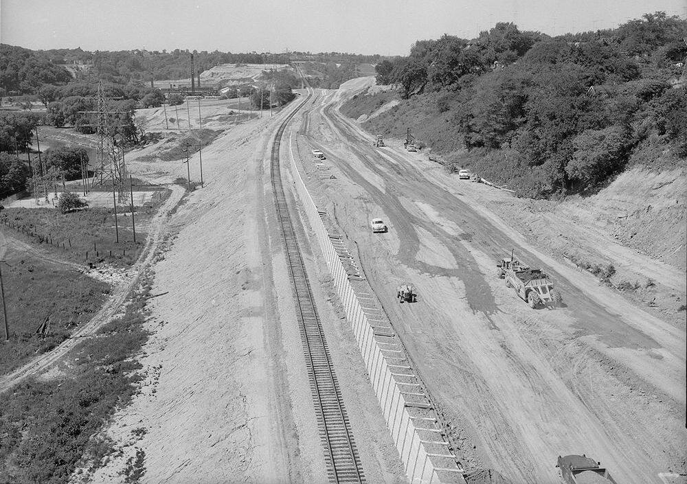
In the 1950s and early 1960s, the Don Valley Parkway (DVP) was constructed through the Lower Don to serve growing commuter traffic. Homes, farms, and cottages in the valley were expropriated.
Increasing development reduced the natural areas of the watershed. This impacted The Don with increased pollution, heavy flooding, and turbid sediment laden waters. The combined result meant that by the 1960s the river was a neglected, polluted mess.
Efforts to restore the Don gathered steam in 1989 with a public forum at the Ontario Science Centre which was attended by about 500 people. The result was the formation of the Task Force to Bring Back the Don, a citizen's advisory body to Toronto City Council. Their mandate and vision was to make the Don "clean, green, and accessible". Since then they have hosted garbage cleanups, tree plantings, and help to create or restore eight wetlands in the lower reaches of the valley. Other groups also became active including Friend of The Don East. In 1995, the MTRCA created the Don Watershed Regeneration Council to coordinate restoration efforts throughout the watershed.
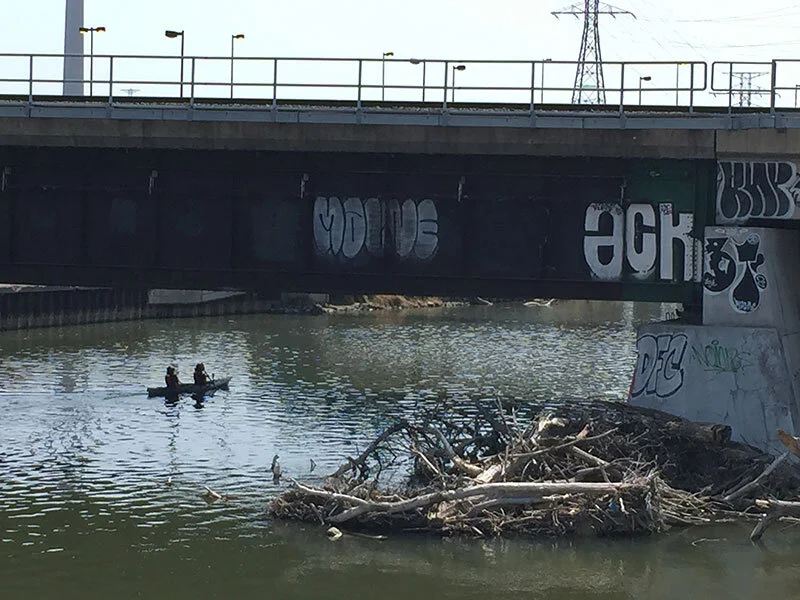
Since the cessation of industrial pollution and the cleanup efforts by various groups, the river has regenerated to the point where a number of species of fish have returned to the river.
In 1991 Bring Back the Don released a document called "Bringing Back the Don" which laid out plans for restoration, including a renaturalized mouth of the Don. In 1998 a plan to revive Toronto's waterfront was initiated. One of the four projects mentioned was a natural mouth for the Don River. In 2001 an environmental assessment was started to look into a natural mouth of the Don. The project was also coupled with a plan to handle a major flood. In 2007, the Toronto Waterfront Development Corporation (now WaterfrontToronto) held a design competition that looked at four different configurations for the mouth of the Don. The winning bid was made by Michael Van Valkenburgh Associates. The environmental assessment was completed in 2008 and construction was began in 2017.

In October 2016, the City of Toronto announced the creation of the Port Lands Flood Protection (PLFP) project. The PLFP project will ultimately transform the existing mouth of the Don River, including the Keating Channel, into a healthier, more naturalized river outlet, while simultaneously providing critical flood protection to 240 hectares of Toronto’s eastern waterfront. The project will have three zones, an urban zone, a park zone and a natural zone. Trails for biking and pedestrian use will be connected from existing ones for recreational and transportation needs. Another aim for the PLFP is restoration of land and the upper sections of The Don River. The project aims to revitalize the ravine space. Together with a series of accessible new entry points, the plan calls for the reclamation of former green spaces throughout the valley. Naturalized ecological conditions throughout the valley would offer improved flood protection.

A "nature-inspired" public art program has also been initiated, aiming to strengthen the cultural presence of the Don Valley. This new park will be under the management of the Toronto Parks, Forestry and Recreation Division. In 2018 the park was renamed as Wonscotonach Parklands with Wonscotonach in Anishinaabe meaning "black burnt grounds".
The PLFP is a key component of Waterfront Toronto and the City of Toronto’s plans to renew and revitalize Toronto’s waterfront, and is scheduled to be completed in 2024.